
Urban cartography has long been an authoritative matter: companies or authorities invested time, energy and money in researching the data and information to be published in city maps.
The wide use of mobile internet is about to change this set-up dramatically. Smartphone users today collect data about how they move through the city, they comment on places they have been to and post geo-tagged photos on social networks. Myriads of datapoints are collected second by second.
Most of the time this infrastructure is discussed negatively—in terms of surveillance—or for businesses as a way to make money with user data. However, crowd-sourced traffic information, photos or comments about places in the city also provide a rich wealth of information, which can help understand how these complex urban ecosystems work.
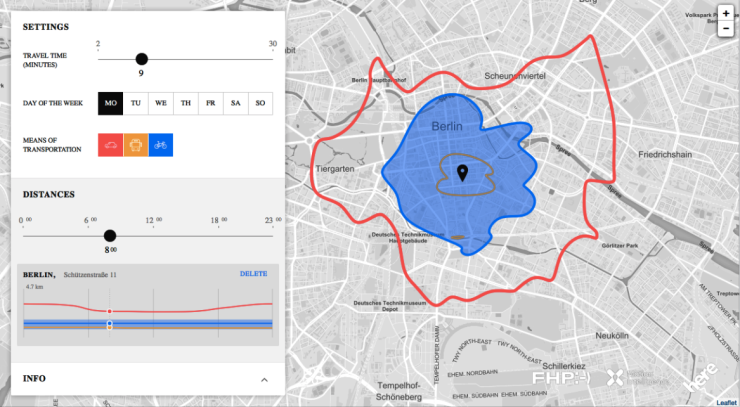
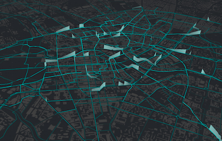
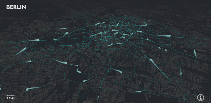
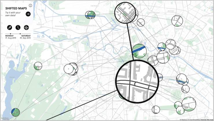
The Urban Complexity Lab in Potsdam has presented several research and design projects of interactive urban cartography in their recent exhibition “Streams and Traces: Mapping the Ephemeral City”.
With their ideas, the team around Boris Müller, Till Nagel and Marian Dörk aim at using this wealth of user-generated data for exploring the inner workings of cities today. They also consider this a contribution towards the democratisation of city maps, with the information generated not by authorities, but users.
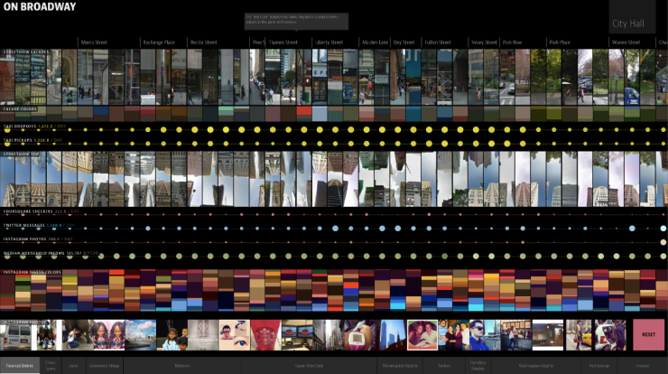
My recent article for “Süddeutsche Zeitung” discusses some of these works, along with another project which I found inspiring last year: On Broadway, an interactive visualisation of city life on one of New York’s most famous streets, created by merging several data sets and drawing from thousands of photos from Instagram.
Here’s the PDF of the article – sorry, German only.
